BUSHFIRE ATTACK LEVEL ASSESSMENTS
BUSHFIRE PRONE AREA MAPPING
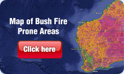
In 2015 the Department of Fire and Emergency Services published the Map of Bushfire Prone Areas. This map identifies those properties that have been designated Bushfire Prone and therefore may require a Bushfire Attack Level (BAL) Assessment to be undertaken as part of the planning application or building permit application process by a Local Government.
To see if your property is within a Bushfire Prone Area follow the link below. If you property is within a Bushfire Prone Area it will be shaded pink.
WHERE DO WE DO BAL ASSESSMENTS
WA Planning & Logistics is able to undertake BAL Assessments on behalf of private individuals or businesses. We are located in Geraldton, Western Australia however we undertake assessments in many locations in the Mid-west, Gascoyne, wheatbelt and other regions as required. Please contact us for an obligation free quote for the cost of this service.
LEAD TIME
It is intended that assessments would be completed within 5 working days for sites within 40km of Geraldton and 7-10 working days for sites outside of this radius as where possible we try and undertake other assessments along the same route to share the cost of travel across multiple clients. Assessments are likely to be returned earlier, however this provides a guide for the timing of services provided and if you need one quickly then we can make it happen for you.
CONTACT US FOR A BAL ASSESSMENT
Should you require a BAL Assessment to be undertaken or would like a quote please phone 0459 186 171 or email your property address to admin@waplanning.com.au

